
Central Mass To Madawaska Maine - PIX!


Thread Starter
Senior Member
Joined: 06-09-2009
Posts: 2,953
From: Clinton, Mass
Central Mass To Madawaska Maine - PIX!
Heading Down East to the northern END of Right Coast Rt. 1.
I've been to the southern END near The Green Parrot Bar in Key West but never gone all the way up they-ah.
Mr. Google tells me it'll take 7.5 hours each way but I'm only taking the interstate on the way back.
I plan to go thru Twin Mountain NH, Rangeley Me, Jackman, past Moosehead Lake, through Baxter State Park then shoot up to the Northernmost point of the US this side of Alaska.
Look at from Leominster, Mass to Madawaska Maine on Google Maps then look at my route.
I won't get there until after midnight then I'm driving back. Wheeeee!
I'll post some pix when I get back tomorrow
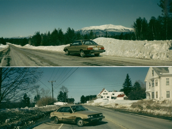
Meanwhile here's Mt. Katahdin in March in my old Scoobydoobaroo about 15 years ago.
Before & after going through 40+ miles of dirt roads in Baxter State Park with my front wheel drive (NO AWD!)
I had about $20 and an empty tank when I got back that time. No suspense!
I've been to the southern END near The Green Parrot Bar in Key West but never gone all the way up they-ah.
Mr. Google tells me it'll take 7.5 hours each way but I'm only taking the interstate on the way back.
I plan to go thru Twin Mountain NH, Rangeley Me, Jackman, past Moosehead Lake, through Baxter State Park then shoot up to the Northernmost point of the US this side of Alaska.
Look at from Leominster, Mass to Madawaska Maine on Google Maps then look at my route.
I won't get there until after midnight then I'm driving back. Wheeeee!
I'll post some pix when I get back tomorrow
Meanwhile here's Mt. Katahdin in March in my old Scoobydoobaroo about 15 years ago.
Before & after going through 40+ miles of dirt roads in Baxter State Park with my front wheel drive (NO AWD!)
I had about $20 and an empty tank when I got back that time. No suspense!
Last edited by Mowgli; Sep 17, 2009 at 04:19 PM.
Thread Starter
Senior Member
Joined: 06-09-2009
Posts: 2,953
From: Clinton, Mass
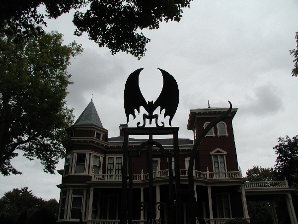
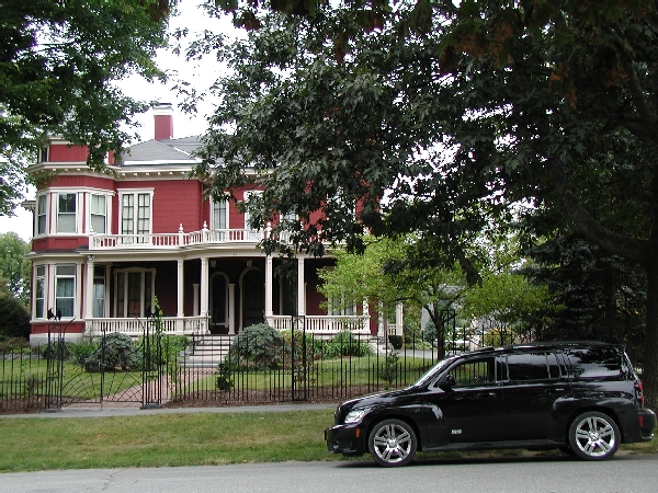
I didn't go through Baxter this time but I stopped at Stephen King's house on the way home.
I logged 1163 miles since noontime yesterday.
I did go to Madawaska and got some very cool pix that I'll post when I recuperate enough to sort through them.
I logged 1163 miles since noontime yesterday.
I did go to Madawaska and got some very cool pix that I'll post when I recuperate enough to sort through them.
Last edited by Mowgli; Sep 17, 2009 at 04:19 PM.
Thread Starter
Senior Member
Joined: 06-09-2009
Posts: 2,953
From: Clinton, Mass
I rolled into Ft. Kent Maine at around sunrise yesterday.
It's cloudy and cold in the AM
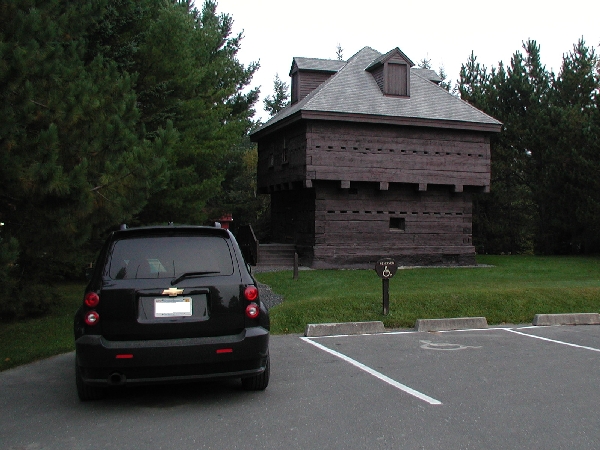
Here's a shot of the Fort Kent blockhouse and one looking across Saint John River from Madawaska Me. to Edmundston NB
It's cloudy and cold in the AM
Here's a shot of the Fort Kent blockhouse and one looking across Saint John River from Madawaska Me. to Edmundston NB


Thread Starter
Senior Member
Joined: 06-09-2009
Posts: 2,953
From: Clinton, Mass
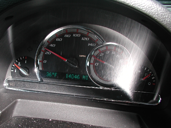
33.6 MPG over the course of 1163 miles.
Mostly conservative driving but some passing on the freeway.
I also took a gray road (at The Forks) on the map that shouldn't have shown to be connected.
It started fine for ~5 miles then tuned into a good dirt road for a few miles.
Then it turned not-so-good.
I have a 4WD Mitsu pickup that I four-wheel with.
I have also gotten myself out of bad situations that I got myself into.
This looked like it was turning into one but I was 60 or more miles out of my way if I turned back so I tried it.
I drove about 2 miles on not-so-good when it turned into pretty bad.
I've been on pretty bad roads that turned great within a few minutes so what the hell.
I drove down pretty bad until it turned into no****inway.
I'd been driving from one side of the road to the other to avoid rocks and ruts for a couple of minutes when I finally called Onstar to ask if I was past Shirley Bog yet.
She said I was still on Shirley Tote Road so hadn't reached the county line yet.
I still had at least a mile before the bog and another 3-4 miles to get to a paved road.
I scared a moose ahead where the "road" was starting to show dampness a full mile before the bog.
It was losing elevation, the rocks were getting more numerous and I was in a low clearance 2WD brand-new-car.
I made a 7-point turn and went back.
I'd like to bring my 4X4 up there to see how much farther I could have gone and just how bad it gets but it's over 250 miles to get there from here.
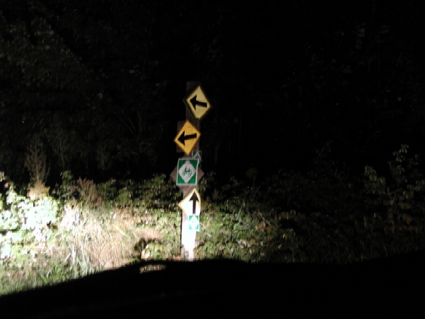
Here's a WTF sign post I passed while it was still pretty good road (for The Great North Woods).
Here's the link to the bad road if you want to try it.
Or zoom out to see where I was and what corner of The Woods not to take your HHR
http://maps.google.com/maps?f=d&sour...y+mills,+Maine
Mostly conservative driving but some passing on the freeway.
I also took a gray road (at The Forks) on the map that shouldn't have shown to be connected.
It started fine for ~5 miles then tuned into a good dirt road for a few miles.
Then it turned not-so-good.
I have a 4WD Mitsu pickup that I four-wheel with.
I have also gotten myself out of bad situations that I got myself into.
This looked like it was turning into one but I was 60 or more miles out of my way if I turned back so I tried it.
I drove about 2 miles on not-so-good when it turned into pretty bad.
I've been on pretty bad roads that turned great within a few minutes so what the hell.
I drove down pretty bad until it turned into no****inway.
I'd been driving from one side of the road to the other to avoid rocks and ruts for a couple of minutes when I finally called Onstar to ask if I was past Shirley Bog yet.
She said I was still on Shirley Tote Road so hadn't reached the county line yet.
I still had at least a mile before the bog and another 3-4 miles to get to a paved road.
I scared a moose ahead where the "road" was starting to show dampness a full mile before the bog.
It was losing elevation, the rocks were getting more numerous and I was in a low clearance 2WD brand-new-car.
I made a 7-point turn and went back.
I'd like to bring my 4X4 up there to see how much farther I could have gone and just how bad it gets but it's over 250 miles to get there from here.
Here's a WTF sign post I passed while it was still pretty good road (for The Great North Woods).
Here's the link to the bad road if you want to try it.
Or zoom out to see where I was and what corner of The Woods not to take your HHR
http://maps.google.com/maps?f=d&sour...y+mills,+Maine
Last edited by Mowgli; Sep 18, 2009 at 11:35 PM.

Thread Starter
Senior Member
Joined: 06-09-2009
Posts: 2,953
From: Clinton, Mass
Right now I'm building a trip plan for today.
Probably going to bang a left near Portland to get to Bethel for a jaunt to Rangeley Lakes Region.
Or I'm jetting up I93 to Twin Mountain NH and taking Rt. 2 to Bethel.
There's no direct way.
Can't get thaaya from heeya.
http://maps.google.com/maps?f=d&sour...49&ie=UTF8&z=8
93N to Rt2 east is an hour quicker and not a bad ride past the Nashua, Manchester & Concord traffic so that's a no brainer
I'm gonna catch leaf-peepin traffic anyway I go North so there it is.
Rangeley Lakes Region is filthy with moose, fox, deer, coyote, porcupine and whatever
There's about a 50 mile stretch between Errol NH & Rangeley ME that has moose paths leading away from and alongside the road almost the whole way.
